Drone surveying and mapping take the spotlight today as we delve into their dynamic world. Forget the fancy jargon; we’re here to explore how Indy Drone Videos is making precision accessible to industries like real estate, construction, and land development. So, let’s cut to the chase and discover how these aerial wonders are transforming the game.
Significance of Drone Surveying and Mapping Services
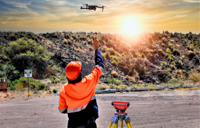
Imagine you’ve got a vast expanse of land, and you require meticulous measurements and data for your project. Enter drone surveying and mapping services! Indy Drone Videos offers a revolutionary solution that combines the efficiency of drones with cutting-edge technology to provide you with precise, real-time data. No more laborious hours of manual measurements or guesswork – drones accomplish the task swiftly and with unmatched accuracy.
But why is precision so crucial? Picture yourself as a real estate developer planning a new housing project. The accuracy of your land measurements can determine your project’s success. Traditional surveying methods can be time-consuming and susceptible to human errors. However, with drones, you gain a significant advantage. They can cover expansive areas quickly and capture data with remarkable precision.
Precision Meets Cost-effectiveness
What’s better than accuracy? Accuracy that doesn’t deplete your budget! Drone surveying and mapping services present a cost-effective alternative to traditional methods. With drones, you can cover vast areas in a fraction of the time and without the need for extensive human resources. This translates to substantial savings for industries like real estate, construction, and land development.
Consider the construction industry, for instance. Time is money in construction, and delays can be costly. Drones can soar above construction sites, capturing detailed images and data that project managers can use to monitor progress. This real-time information helps identify potential issues early on, allowing for prompt adjustments and cost savings.
Advanced Technologies in Action
Now, let’s talk tech. Indy Drone Videos doesn’t just operate drones; they employ advanced technology to capture high-resolution imagery and generate intricate maps. These maps aren’t mere visual aids; they’re invaluable tools for project management and decision-making. Need to track progress on a construction site? Drone footage has got you covered. Want to assess the topography of a piece of land? Drones can accomplish that as well. It’s all about efficiency and data-driven decision-making.
The technology underpinning drone surveying and mapping services has made remarkable strides. These drones are equipped with high-resolution cameras, GPS systems, and even lidar sensors, which use laser beams to measure distances with unparalleled precision. All this data is then processed using specialized software to create detailed maps and 3D models.
Wrapping It Up
In a nutshell, drone surveying and mapping services are revolutionizing precision and efficiency in industries that demand it. Indy Drone Videos is your partner in this transformation, offering accessible, cost-effective, and accurate solutions.
Consider the potential impact on land development. Precise mapping of terrain can empower developers to make informed decisions about where to build, how to design infrastructure, and even how to manage water flow. In the real estate industry, drone imagery can provide potential buyers with a breathtakingly detailed view of properties, enhancing their decision-making process.
Your Drone Surveying and Mapping Ally: Empowering Your Vision with Indy Drone Videos
If you’re ready to harness the power of drones for surveying and mapping, Indy Drone Videos has your back. Their experienced team and cutting-edge technology ensure that your projects are in capable hands. Say farewell to guesswork and embrace precision.
Think about the peace of mind that comes with knowing your project is entrusted to experts who utilize the latest technology to deliver top-notch results. Indy Drone Videos’ team of skilled pilots can navigate drones through even the most challenging environments, ensuring you get the data you need without hassle.
Ready to unlock precision? Contact Indy Drone Videos today to embark on a journey into the world of drone surveying and mapping services. Let’s ascend to new heights together.