What is Drone Mapping?
Drone mapping refers to the use of unmanned aerial vehicles (UAVs) equipped with specialized cameras and sensors to capture data and images of a given area. This data is then used to create detailed maps and 3D models of the area, which can be used for a variety of applications ranging from surveying and construction to environmental monitoring and agriculture.
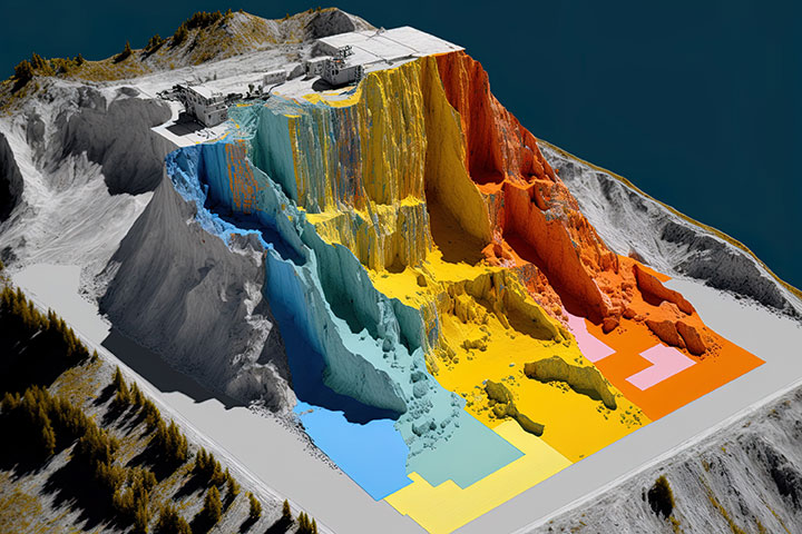
The process of drone mapping typically involves the use of high-resolution cameras, such as RGB or multispectral cameras, to capture images of the area of interest. These images are then processed using specialized software to stitch them together and create a high-resolution map or 3D model of the area. The software can also analyze the data captured by the sensors to provide insights into the area, such as topography, vegetation cover, and even soil composition.
Benefits
One of the primary benefits of using drone mapping is the ability to capture data and imagery from areas that may be difficult or dangerous to access using traditional methods. For example, drones can be used to map areas affected by natural disasters, such as floods or landslides, where access may be restricted due to safety concerns. Similarly, drones can be used to map remote areas, such as forests or mountains, where traditional surveying methods may be impractical.
Drone mapping is also a highly efficient and cost-effective method of mapping large areas. Drones can cover vast areas in a relatively short amount of time, and the data they capture can be processed quickly using specialized software. This makes drone mapping an attractive option for applications such as land surveying, construction, and infrastructure development.
Agriculture
In the field of agriculture, drone mapping is increasingly being used to optimize crop yields and improve efficiency. By mapping crop fields, farmers can gain insights into soil composition, vegetation cover, and irrigation needs. This data can then be used to develop targeted interventions, such as adjusting fertilizer application rates or identifying areas where additional irrigation is needed.
Construction
In the construction industry, drones are being used to improve safety and efficiency on job sites. By mapping construction sites, project managers can gain insights into the progress of the project and identify potential safety hazards. This information can then be used to develop targeted interventions, such as adjusting work schedules or implementing additional safety measures.
Another emerging application of drone mapping is in the field of environmental monitoring. Drones equipped with specialized sensors can be used to monitor environmental indicators such as air quality, water quality, and vegetation cover. This data can then be used to develop targeted interventions, such as implementing measures to reduce air pollution or restore degraded ecosystems.
Drone Mapping in Indiana
In conclusion, drone mapping is a powerful tool for capturing detailed data and imagery of a given area. Its applications range from land surveying and construction to agriculture and environmental monitoring. There are significant advantages in terms of efficiency, cost-effectiveness, and safety, making it an increasingly popular option across a range of industries.
At Indy Drone Video, we specialize in drone mapping. To get a quote for in Indianapolis, or anywhere around Indiana, contact us!